
Durupinar
The Durupinar or canoe-shaped/boat-shaped mound site (popularized by Ron Wyatt) is named after Turkish Captain llhan Durupinar who identified the formation in a Turkish Air Force aerial photo while on a NATO mapping mission in 1959. There is an old settlement near the site named Nasar. The Durupinar site is located about 2 miles north of the Iranian border, 10 miles southeast of Dogubayazit, and 18 miles south of the Greater Mount Ararat summit. When Rex Geissler studied all over and around the formation in 2000 and 2001, the GPS coordinates for the lowest spot on the formation were 39 degrees 26.470 minutes North latitude and 44 degrees 14.110 minutes East longitude and 1,874 meters altitude with the top of the formation at 39 degrees 26.391 minutes North latitude and 44 degrees 14.049 minutes East longitude and 1,911 meters altitude.
Both geologist Clifford L. Burdick and archaeologist William H. Shea wrote articles in the Creation Research Society Quarterly about this site in September, 1976. However, many people identify the site with the deceased Ron Wyatt. Ron Wyatt had no formal training in archaeology or in geology, which is a shame since Turkish geologists now believe that the Durupinar site is nothing but a geologic formation. Seventh Day Adventist (SDA) Ron Wyatt was a nurse anesthetist (a CRNA) from Madison, Tennesse, and “Indiana Jones”-type adventurer who was extremely charismatic but who also had a wild side. For example, Wyatt stuffed illegal rock samples from the Durupinar site in other researchers’ luggage like Elfred Lee’s as they were approaching Turkish airport search/metal detectors. After 27 years of Durupinar obscurity, Ron Wyatt and the late David Fasold popularized the site in the late 1980’s and early 1990s. Ron Wyatt also claimed that the biblical Mt. Sinai was in Saudi Arabia at Jebel al-Lawz.
 In 1948, an AP article reported that a man named Reshit found Noah’s Ark, the end of which was as big as a house, sticking out of the ice, high on Mount Ararat. Reshit is a common name in the region. Dr. A.J. Smith and a contingent from the United States and Turkey went to the Ararat area just one year later in 1949 and did not find this person within a “100-mile search area” although they did not conduct a detailed search. In 1967, SDA Television Evangelist and Archaeological Research Foundation (ARF) pioneer George Vandeman said he met with the Reshit that the 1949 AP story was based upon on the northeast side of the mountain near Ahora Village but that Reshit was now too old to lead them to the location. Almost forty years later in 1986, David Fasold claimed that he found a Reshit with the complete name Ali Oglu Reshit Sarihan who lived in Uzengili just above the Durupinar site. Fasold claimed that this “Uzengili Reshit” was the one which the 1948 AP article was based upon. He also alleged that this Uzengili Reshit really meant Durupinar (which gets snow but not ice) rather than the ice cap of Mount Ararat (17 square miles of ice cap up to 300 feet deep) which is 18 miles across the valley to the north. Uzengili Reshit said that the formation began with three earthquakes occurring close together in 1948 and that the formation became more distinctive with each earthquake. The 8mm videotape of Fasold with the Uzengili Reshit has apparently been lost when David Fasold died. However, David Fasold did publish an interview by a Thomas Anderson of California with the Uzengili Reshit in his Ark-Update newsletter five years after the fact in 1991. Although it does indicate that this Reshit was a longterm resident of Uzengili (born 1926 in Dogubayazit) and was familiar with the Durupinar formation and how it was geologically formed by several earthquakes (before May 1948 he claimed that the formation was a wheat field), it is still debatable that this Uzengili Reshit is the one that the 1948 article was based upon. Uzengili Reshit initially thought that the formation was a treasure and that he might find some old treasure in the cracks of it. There are several problems with the interview.
  First, the interviewer Anderson had to place complete trust in the translator since he did not speak Turkish or Kurdish. Second, beginning with the first question, the interviewer immediately assumes that the Durupinar geologic formation “is” Noah’s Ark, thereby showing his obvious bias which makes one question the entire interview by tainting the witness by his own assumptions. Third, there was much confusion about when and how extensive were the earthquakes in the region as Uzengili Reshit said it was 1978, the interviewer Anderson stated 1968, and the translator said 1958, which forced the interview to be halted after only a few questions. Fourth, in comparison to the 1948 AP article, no mention is made about any earthquakes or to a wheat field being destroyed. Fifth, also unlike the 1948 AP article, Uzengili Reshit mentions nothing about a boat sticking out of the ice high on Mount Ararat. Objective researchers can discover further contradictions by simply reading the original 1948 AP Article at this link. So either the AP article was nothing like Uzengili Reshit’s story or Fasold found the wrong Reshit.
Another reason why people like Durupinar is that there are alleged name-places around the area which point to a bibilical-type flood and survival of eight people through a boat. The problem again with this line of reasoning is that other Urartian sites have similar name-places, let alone all around Persia and the Near East. Both the Mount Ararat area and Mount Cudi area have similar name-places, so how does one decide which is the correct site? In fact, after Durupinar was dubbed “Noah’s Ark,” they started thinking that Mount Cudi must be nearby so low and behold, around 1995, the mountain above Durupinar was renamed “Mount Cudi,” which makes it at least the fifth “Mount Cudi” in the Near East. “Revisionist History” like this example is typical when people stretch the truth to make their point. Unfortunately, many naive Seventh Day Adventists seem to have gotten tangled up in promoting this location. Fortunately, scientifically trained Seventh Day Adventists such as the Archaeological Research Foundation’s (ARF) Clifford Burdick, Dr. David Merling of Andrews University, and Allen Roy help prevent the naive view from going too far. the actual evidence and responsible Turks pull back support from this site. ArcImaging’s B.J. Corbin visited the Durupinar site in 1989, 1990, and 1998, and does not believe that it is the remains of Noah’s Ark. Corbin viewed similar boat/canoe-shaped formations near Mt. Ararat during helicopter flights, and the formation appears natural and similar to the surroundings and earthflow. ArcImaging’s Rex Geissler and an archaeologist also visited the site in 2000, 2001, and 2006 and were unimpressed by its archaeological significance. The natural qualities of the geologic flow down the length of the hill are obvious. Corbin and Geissler contend that a professional dig of the site would be in order, along with independent, expert analyses of the contents as most interested parties have preconceived biases for or against the site.
The Learning Channel broadcast a film July 31, 1995, about the work of Wyatt, Fasold, and John Baumgardner Ph.D. However, as evidence against Durupinar has mounted and initially interested people like Arthur Brandenberger Ph.D. of Ohio State University (1959-1960) and Dr. John Baumgardner of Los Alamos National Laboratories (1980s-1990s) pulled back their support of the formation, the Durupinar supporters seem to have evolved their views. As the current view goes, Durupinar is no longer the actual remains of Noah’s Ark where Ron Wyatt stated it contained trainloads of wood inside of the formation, but rather Durupinar is an imprint at the location where Noah’s Ark stopped after the 500 foot long boat slid down the hill several thousand feet via a geologic flow which amazingly, did not turn the boat over or destroy its shape whatsoever. Advocates state the support that the Turkish Government gave the site during the 1980s. However, at the 2005 Mt. Ararat and Noah’s Ark Symposium hosted by Istanbul University Prof. Octay Belli and the Governor of Agri, Gerrit Aalten stated that Turkish Geologist Murat Avci (whose Resume/CV is provided here to show his credibility) gave a very nice presentation on the subject of Durupinar. Through a PowerPoint presentation and the following paper, Murat Avci made it scientifically clear that the Durupinar site is just a freak of nature and nothing special or manmade. The title of the presentation was “Geomorphological Surface Shape that looks like a Ship Form in Agri” or “The Formation and Mechanics of the great Telceker Earth Flow.” Ironically, Murat Avci’s primary point about the site is that the formation was a portion of the original cliff that slid down the earth flow and stopped at the current location, ironically a similar concept as the new view of the Durupinar believers, except that the earth flow was geological rather than a man-made structure or imprint. Beside this presentation and the associated geologic paper made available at the 2005 Mt. Ararat and Noah’s Ark Symposium, there was almost no mention of Durupinar during the entire five-day conference, except in a summary of touristic sites in the province of Agri, which says a lot about how the Turkish Government and the scientific authorities in Turkey view the Durupinar site today…
According to the Ron Wyatt view, the ark later deteriorated or was scavenged and destroyed. The alleged “anchor” stones fifteen miles away at Kazan are extremely controversial and have better explanations detailed in the following:
Hole Stones of Arzap by Gerrit Aalten
Mount Ararat Archaeological Survey discussing the Hole Stones
Durupinar followers tend to refer to researchers interested in the ice of Greater Mount Ararat which is 11,000 feet higher than Durupinar as “Mountain Men.” Notably, many Durupinar followers are unaware that Urartu formed such an extensive geographic region which included tens of thousands of square miles including thousands of mountains with other possible ark landing locations. Just a few are listed here: Sabalan (16,800 feet), Sahand, Alborz, and Cudi Dagi, as well as Ararat. To include heights at 5,000 feet or higher in the biblical “mountains of Urartu” would be too numerous to count. Durupinar supporters also tend to not be seriously open to alternative views as seen by their links from their websites which normally include only pro-Durupinar sites and do not even include this website even though many alternative views are discussed in this account. As the 21st century opens, people who seem to revere Ron Wyatt (especially naive Seventh Day Adventists located in Tennessee, California, Australia, and northern Europe) continue with a high interest in further research of the geologic formation and close vicinity but this may slow down as they consider
Durupinar Site Photos
1959 Photo:
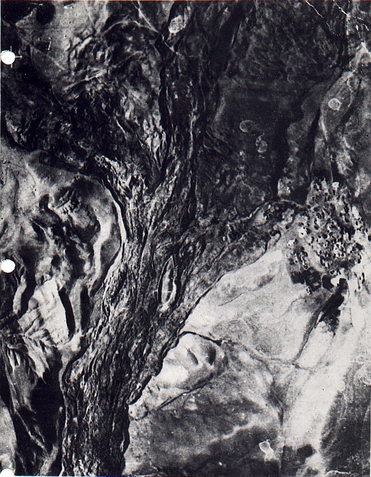
Original Durupinar Photo 1959 by Captain Ilhan Durupinar
Rex Geissler Photos:
Durupinar Photo Album
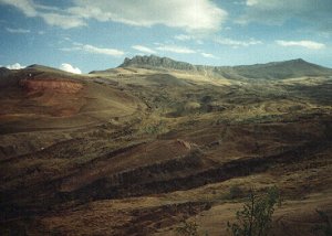
Durupinar Photo #1
Durupinar Photo #2
Durupinar Photo #3
B.J. Corbin Photos:
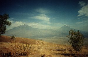
Big and Little Ararat from the Visitors Center
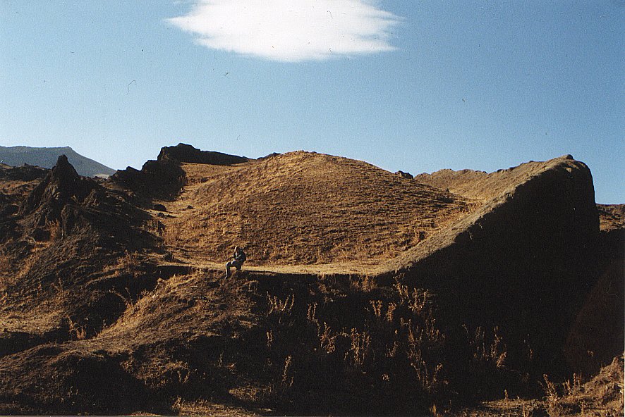
Durupinar Photo 1998
Durupinar from the Visitors Center 1998
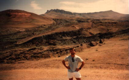
B.J. in front of the Durupinar Site 1990
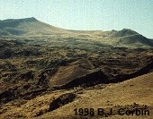
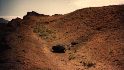
Top left side 1990
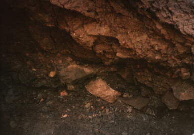
Hole blasted out 1990
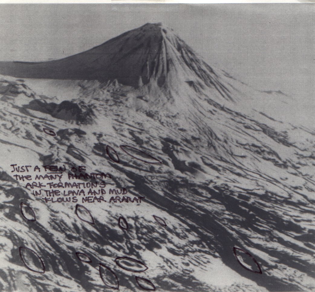
Other Canoe/Boat Shapes Around Little Ararat Across Valley: Photo Courtesy of Charles Willis, M.D. via Robin Simmons:
Other Canoe/Boat Shapes
Other Canoe/Boat Shapes with Outlines
Scientific Evidence Against Durupinar:The Formation and Mechanics of the great Telceker Earth Flow by Turkish Geologist Murat Avci
Article by John Morris, Ph.D. in Geology
Letter from Thomas Fenner, Geophysicist
Letter from Joe Zias, Curator of Anthropology/Archaeology, Israel Antiquities Authority
“Ron Wyatt: Are His Claims Bonafide?.” by Bill Crouse, President of Christian Information Ministries
People For Durupinar (Mostly Seventh Day Adventists & Ron Wyatt Followers):